|
|
||
|
Home | Latest | Night Sky | Nature | People | Monuments | Motion | Misc. | Search |
||
|

|
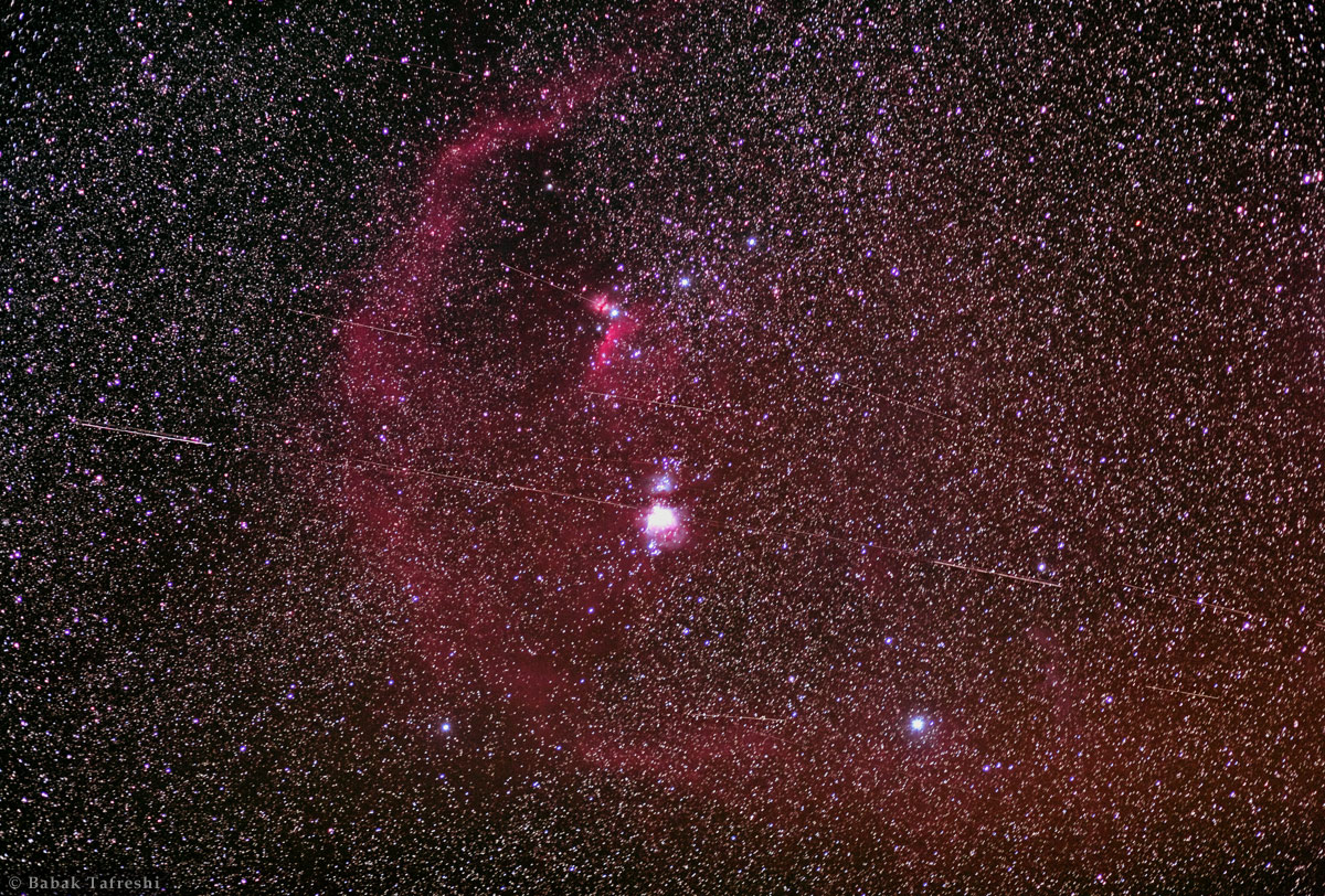
Geostationary Highway - By: Babak A. Tafreshi
As seen on NASA's Astronomy Picture of the Day Geostationary Satellites in the night sky, trailing against the constellation Orion and its large cosmic clouds. Satellite in a circular orbit about 36,000 kilometers above the Earth orbit once in 24 hours. Because that matches Earth's rotation period, it is known as a geosynchronous orbit. If that orbit is also in the plane of the equator, the satellite will hang in the sky over a fixed location in a geostationary orbit. Geostationary orbits are in common use for communication and weather satellites. Deep images of the night sky made with telescopes that follow the stars can also pick up geostationary satellites glinting in sunlight still shining far above the Earth's surface. Because they all move with the Earth's rotation against the background of stars, the satellites leave trails that seem to follow a highway across the celestial landscape. In this view of the equatorial Orion region, individual frames were added to create a 10 minute long exposure. It shows Orion's belt stars and well-known nebulae along with many 2.5 degree long geostationary satellite trails. See these satellites in motion. Date: 2010 Feb. 17
< Previous ................ Next >
|
|